
Google maps California and Colorado wildfires to help you escape the flames
- edbaig
- Aug 20, 2020
- 2 min read


The devastating wildfires raging throughout California, Colorado and elsewhere force evacuations, disrupt lives and livelihoods, and cost billions of dollars annually. But where can one go to safely escape the flames?
Google is trying to help. On Thursday, Google launched “wildfire boundary maps” in the U.S. to help people avoid active blazes. Inside Google Maps, or when you enter a search query related the fires, you’ll see the fire’s name, location, germane news articles, and approximate size and scope, with its boundaries mapped as a digital polygon. Google will also surface local and emergency resources, part of the SOS alerts feature the search giant launched three years ago.
Wildfires can be detected from airborne and space-based platforms, but as Google explains this comes with both benefits and obstacles.
“Flying near or over an active fire can provide data with very high spatial and temporal precision,” the company blogged. “But it’s not always an option, as it requires significant operation costs and does not scale easily over entire states and countries.”
Google leverages data from the National Oceanic and Atmospheric Administration’s (NOAA) GOES constellation of satellites, which have optical and infrared sensors that can detect “hot spots.” The data is refreshed every hour or so.
Data is also culled and analyzed from Google Earth Engine.
Google is teaming up with government agencies as well, including the California Office of Emergency Services.
"The public-private partnership that we have with Google...couldn't have come at a better time," says Abby Browning, chief of the Office of Private Sector/ Non-Governmental Organization Coordination, at CalOES. "2020 is a very weird year. We have COVID-19 that is still rampant across the country. We have economic strife across the country. In California we now have record high heat waves across the state, lightning storms like crazy and (as of Wednesday) we are tracking about 360 fires."
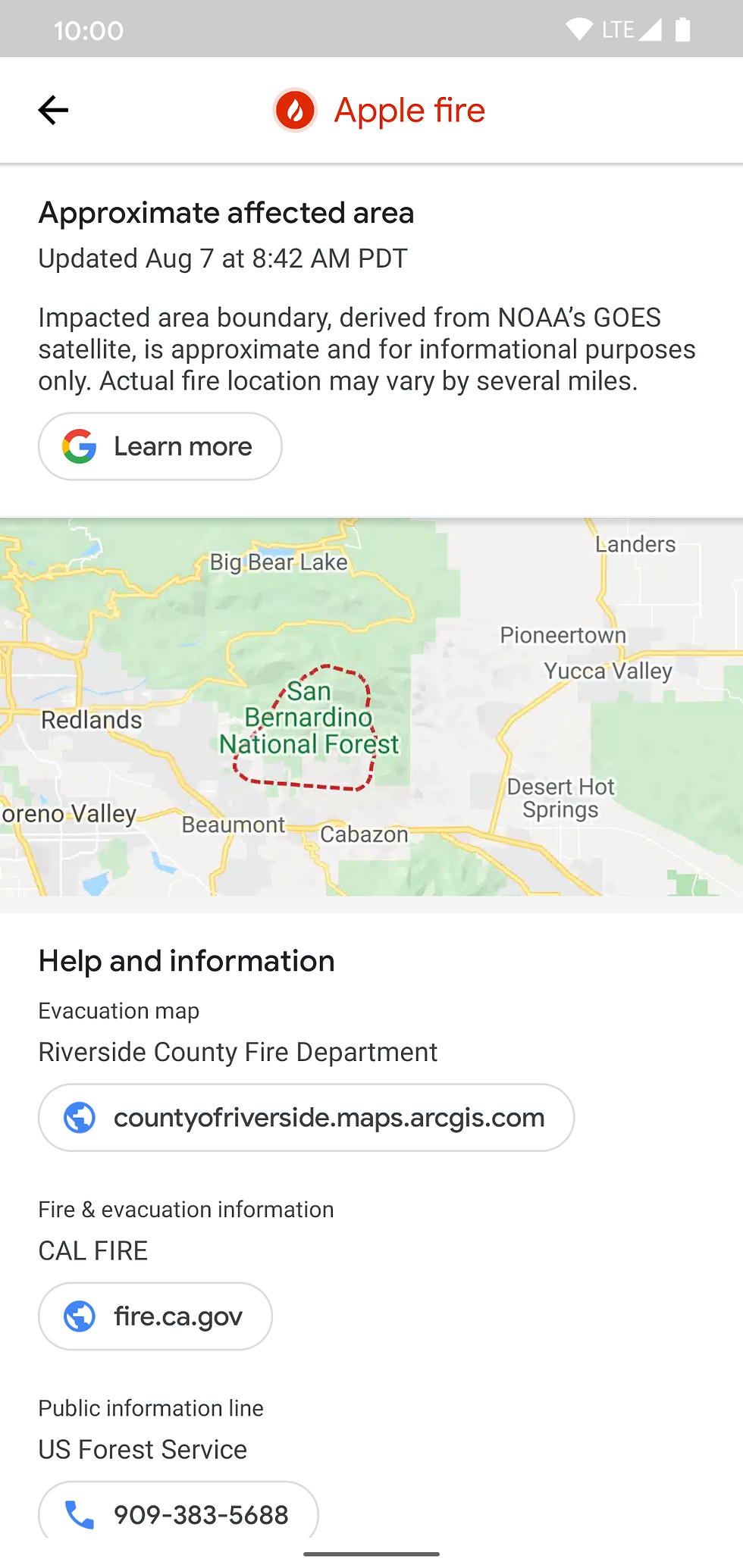
If multiple large fires are active in an area you may see several digital polygons.
“Mapping where they happen and how they grow provides critical information for a wide range of people,” Google blogged. “For first responders and communities near a wildfire, knowing where a blaze has been developing in recent hours can help inform evacuation orders and suppression plans. For long-term analysis and planning, looking back at where and how fires developed can improve prevention and management of future wildfires.”
Google piloted a feature is Search SOS alerts for California fires last year. But Google has been trying to respond to crises since 2010, starting with the Carmel Mountain fire in Israel. Besides mapping fires, Google has been applying technology to detect earthquakes and forecast floods.
Email: edbaig@gmail.com; Follow @edbaig on Twitter


Comments